
About the project
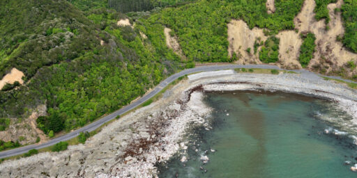
The Hōretireti Whenua Sliding Lands programme will create national-scale landslide models that can forecast where rapid and dangerous landslides are likely to be triggered by earthquakes and rainfall events.
The models will use susceptibility factors such as rainfall, ground shaking, vegetation type, and slope gradient to determine the likelihood and locations of fast-moving landslides across the country for earthquake and rainfall triggers. These susceptibility models will be combined with landslide runout models and vulnerability models to predict the hazard and risk from landslides. From this information our models will determine what the impacts may be, particularly to people, property, industry, and the environment.
The programme will also investigate people’s perception of landslide phenomena, hazards, and the models we develop to understand the risk and impacts of landslides, as well as their perceptions of vulnerability to landslides. Findings will be used to improve the communication and visualisation of model outputs around risk, as well as inform the development of the models themselves.
The effectiveness of the landslide models will be tested and refined using two case studies based in Tairāwhiti and Auckland.